Viewing entries tagged
Hawaii

Share

One of the most moving performances of all time


Above is a video of a live performance by the late great Israel Kamakawiwo'ole that is guaranteed to induce chills, first when Brother Iz launches into singing after his spoken-word introduction, and then when his former bandmates from the Makaha Sons of Ni'ihau join him on stage to sing.

This performance is from the prestigious Na Hoku Hanohano Hawaiian Music Awards from May of 1996, only a year before the passing of Brother Iz.

The song is "Kaleohano," written by his brother-in-law, Moon Kauakahi, who can be seen singing to the right of Iz (Iz's right, or to the left as you look at the video) when he and the other Makaha Sons come up out of the audience to join in the song (which takes place at about 4:18 in the video, and the camera focuses in on Moon Kauakahi at about 4:57 in this video).  His birthday is coming up on July 30.

Here is a reprint of an article describing the show-stopping performance at that 19th annual Na Hoku Hanohano awards, with Brother Iz describing it from his own perspective:
Yeah, that wasn't planned. I didn't know what was going on. I just had my eyes closed. I heard Moon's voice and I opened my eyes and looked to the side and there he was. That was cool, really really cool, awesome.
I was crying, yeah, I was crying. There was a lotta emotion, a lotta feeling of love, an awesome feeling of aloha. That was the perfect example, the epitome, of aloha spirit. Everybody in the state talks about aloha spirit; that was the perfect display. It's all about love, it's all about being Hawaiian, and just love, man, family. 
In the introduction to the song, before he begins to sing, Brother Iz confesses his conviction that the soul lives on beyond the body, saying:
It's only a facade, brah.  It's a thin curtain.  It's only temporary.  Us guys is forever.
(2:15).
Respect.


Share

Share

Birthday of Israel Kamakawiwo'ole


May 20 is the birthday of beloved Hawaiian singer Israel Kamakawiwo'ole, born this day in 1959.  

He is most well-known for his incredible rendition of "Somewhere over the Rainbow" (above).  Here is a link to an NPR segment describing the amazing story behind the recording of that song in 1988, when Brother Iz talked music producer Milan Bertosa into staying at his studio for fifteen more minutes (it was already three in the morning), and then walked in and recorded in one take, accompanied only by his own ukelele.

Here is a link to a previous blog post entitled "What kind of music gives you chills?" which explores the power of music and the impact it can have.  It cites an article that examined songs that have an impact on our "sympathetic nervous system" which concludes, "Music is most likely to tingle the spine, in short, when it includes surprises in volume, timbre and harmonic pattern."  The music of Israel Kamakawiwo'ole is certainly capable of "tingling the spine" and contains all of those elements.

The NPR story cited above also hints at another reason that his music is so powerful and strikes such a chord with listeners.  It quotes Israel's childhood friend and fellow musician Del Beazley:
In Hawaii, we talk about this thing we call mana.  Mana is like an energy that you get. We believe we get ours from the elements first, the Earth, your sky, your ocean, your God, and all that is inside of us. And when we open our mouth to speak, to sing or to play, that's what we let out. But it's that that makes him [Israel] special, because his mana always came out.
Israel often expressed his certainty that the soul continues after the death of the body, and in fact expressed that belief in some of the interview quotations included in that same NPR story.  His music also lives on and continues to convey his positive energy to new generations of listeners.

Rest in peace.  Respect.

Share

Share

Eddie Aikau: May 04, 1946 - March 17, 1978


May 4 is the birthday of Hawaiian hero Eddie Aikau, born this day in 1946.

He was an intrepid North Shore surfer and lifeguard whose willingness to brave the often fearsome Pacific Ocean saved many lives.  His love of Hawaii and desire to preserve and resuscitate Hawaiian spirit and pride are evident in the one part of the above clip in which Eddie Aikau can be heard speaking for himself.

It was these two powerful aspects of his personality that tragically led to his disappearance at sea, when he set out alone to paddle for help, on the third voyage of the Polynesian Voyaging Society traditional vessel Hokule'a, after the Hokule'a had capsized twelve to fifteen miles from shore, and after he and the other members of the crew had waited ten hours in the water without sign of rescue.

His heroic life is truly an inspiration and an example to all people.

One incident of his life that is not as often mentioned, but which also illustrates his stature and the respect that he commanded, was his negotiation of a reconciliation of the tense and violent situation that had developed on the North Shore surrounding the sometimes disrespectful remarks and published statements from non-Hawaiian surfers, as related in the movie Bustin' Down the Door.  The situation is described in detail in the film, beginning around the 55:00-minute mark (although to truly do the story justice, the entire film prior to that point should be seen).

At about 1:12:00 in the film, Rabbit Bartholomew and Ian Cairns, who had published some of the most provocative statements and become the principle targets of those who wanted revenge, describe how they were holed up in a South Shore hotel (in danger of their lives) and heard a knock on the door.
Rabbit:  There was a knock on the door one day, and we opened up the door, Ian's -- I'm there, and Ian's behind me with a tennis racket -- and it was Eddie Aikau.

Ian:  And he just came in and said, 'Look -- you know there are men, men with knives and guns, that want to kill you, for the things you've said in the magazines . . .'

Rabbit:  And he said, 'But, it's gone too far, it's gone beyond the North Shore, it's gone into a much heavier element,' and he said, 'My family, my Dad -- Pops Aikau -- has sent me in, to try to calm the waters a bit here, because it's a very, very serious situation for you two.'

Clyde Aikau:  We did what the Hawaiians called a ho'o pono pono; a ho'o pono pono is, you know, if you've got people who don't agree on something, somehow you bring them, you bring them to your home and then you sit them down and you just hash it out.
This action of reconciliation, in which Eddie Aikau can be seen once again as the one who went into the "stormy waters" of a very intensely-charged situation, was extremely significant for the history of surfing.  It is no exaggeration to say that he probably saved lives by his actions, as well as to say that he may have prevented the derailment of the start of modern professional surfing.

In this incident, just as in the other brave actions he took during his life, Eddie Aikau can be seen to have acted to preserve the dignity, respect, and world-famous Spirit of Aloha of Hawaii and the Hawaiian people and culture.

Our prayers are with the Aikau family this day.

Rest in peace -- Respect.

Share

Share

Duke Kahanamoku


August 24 is the birthdate of Duke Kahanamoku, born in 1890. Above is a photograph of the Duke, aged 21, about 100 years ago. An Olympic gold medalist in swimming, Duke's greatest legacy was his towering role as the first real international ambassador of surfing. He is almost singlehandedly responsible for launching the ancient Polynesian "Sport of Kings" in California and Australia and for generously sharing the stoke where ever he went.

Here is a link to a website describing the first recorded western account of surfing by a lieutenant of Captain Cook on a voyage to Hawaii -- subsequent pages describe the role of Jack London, George Freeth, Alexander Hume Ford, and especially Duke Kahanamoku in reviving the sport of surfing and then spreading it worldwide.

Below is a video showing early footage of Duke surfing at Honolulu with Diamond Head in the background.


The video below describes Kahanamoku's 1915 visit to Australia, where his surfing demonstrations fell on extremely fertile soil and can be directly credited with launching that country's well-known fervor for surfing.


Like other legendary Hawaiian watermen, Duke Kahanamoku was also an actual lifesaver, and once dove into the waves repeatedly to save several fishermen in distress when their boat capsized in heavy surf off of Newport Beach in June of 1925.

Surfers everywhere should be grateful to Duke Kahanamoku for his efforts to spread the ancient Polynesian art of surfing beyond the shores of Hawaii in the best tradition of Aloha.

Peace.

Share

Share

"Listening to the greatest navigators our globe has ever seen"


We recently published two posts (here and here) discussing the awe-inspiring voyages of the Polynesian Voyaging Society's traditional double-hulled ocean-going canoe Hokule'a and the nearly-lost navigational techniques they use to travel thousands of miles across the open sea using the stars, the sun and moon, and the subtle directional clues provided by the ocean swells, the colors of the sky and sea at sunrise and sunset, and the activities of marine wildlife and birds.

Polynesian Voyaging Society President and Hokule'a wayfinder Nainoa Thompson learned these traditional techniques from master navigator Mau Piailug (1932 - 2010), and he graciously explains some of the outlines of that ancient wisdom on the PVS website and passes it along in person to new students of the craft who participate in the ongoing voyages of Hokule'a.

On this page, entitled "The Celestial Sphere," the PVS explains the celestial mechanics of the circling stars, as well as the celestial mechanics of the paths of the sun and moon throughout the year. It is well worth studying and understanding, and is explained clearly and with excellent diagrams. As explained on that page, an observer at the north pole, looking up at the night sky, would see the entire celestial sphere turning around a point directly overhead (see diagram below).


The north star, marked in the diagram above by a star, would not appear to move (actually, because it is just slightly off of the exact true celestial north pole, it would move in a tiny circle, but for purposes of this discussion it can be understood to mark the celestial north pole and thus to remain stationary while the rest of the sky appears to turn). However, stars that are located some angle away from the north celestial pole would appear to trace out a circle around the celestial north pole as the earth turns. These circles are marked in the diagram above as blue circles with arrows indicating the direction of the star's apparent daily motion (opposite to the direction of the earth's rotation).

The Polynesian Voyaging Society, however, does not typically sail across the north pole, but rather through the Pacific latitudes north and south of the equator. To an observer sailing across the equator, the apparent motion of the stars in their courses would be quite different than to our observer sitting at the north pole. Below is a diagram of the courses of the stars at the equator.


In this image, the surface of the ocean upon which the observer is sailing has been added as a light-grey disc. The north celestial pole and the north star are now located on the horizon at due north (left in this diagram and marked with the north star). The south celestial pole is similarly located on the horizon at due south (not depicted on the diagram above). The courses of the stars will now be perpendicular circles, but half of these circles will take place below the horizon. As the earth turns, the stars will appear to rise out of the eastern horizon in vertical courses, arc overhead, and descend on vertical courses to the western horizon, where they will again disappear.

We can now understand how an expert navigator who knows the stars could set his vessel's course by lining up known sight-marks on the beam of his vessel with a known rising star. If he were exactly at the equator, for example, and wanted to head due north, he could sight to a star known to occupy declination 0° (along the celestial equator) and keep it 90° to his course, thus pointing his prow due north. He could use such a star even after it had risen many degrees in the night sky, because he knows it rises perpendicular to the horizon and thus he can mentally trace its course back down to the horizon and use it for many hours as a guide. If he wanted to take a heading some degrees west of due north, he could sight to a star along the celestial equator but place it those same number of degrees further than 90° to his starboard beam, thus turning his prow west of north by that number of degrees (or, as described on this webpage, within one of 32 headings of 11.25° degrees each, each of which can also be divided for even greater precision).

Likewise, if he knew of a star that was at declination +19° (which is to say, 19° on the north side of the celestial equator) and he did not have a star along the celestial equator to use, he could still orient his vessel due north by lining up that star's rising point 19° forward of due east (or at 81° in his mental compass). If he desired a heading that was west or east of north by some number of degrees, he would simply make the desired adjustment to the alignment that he kept that star.

Between the north pole and the equator, the stars in their courses will not rise perpendicularly out of the ocean as they do at the equator, nor will they make circles in the sky parallel to the horizon as they would at the north pole. Instead, the north celestial pole will be tilted by the same number of degrees that the observer is north of the terrestrial equator. In the diagram below, the observer has proceeded north from the equator to a latitude of about 30° north, and because he is going towards the north star it is rising up out of the ocean as he proceeds north (remember that it was on the horizon at due north when the vessel was at the equator). As it rises up, the stars in their courses which appear to circle the north celestial pole due to the rotation of the earth will still trace out perfect circles, but these circles will now be tilted as indicated in the diagram.


The navigator could still set his course by a star rising along the celestial equator or rising at a known declination on either side of that celestial equator (such as our star tracing a circle at a declination of 19° on the north-star side of the equator), but he must remember that the star no longer rises perpendicularly as it did at the equator, so as it climbs higher in the night sky he must mentally draw it back to the horizon at an angle corresponding to his vessel's northerly latitude.

All of this fascinating detail is described on the Polynesian Voyaging Society website page discussing the Celestial Sphere and also on this page entitled "Holding a Course."

Perhaps the most fascinating detail of the techniques that Nainoa Thompson uses is described on the page entitled "Hawaiian Star Lines and Names for Stars." There, the text explains that, "To help remember the pattern of stars in the sky, Nainoa Thompson has organized the sky into four star lines, each line taking up about one fourth of the celestial sphere." These star lines are quadrants of the celestial sphere like the wedges of an orange cut into four equal wedges. As the earth turns, these wedges or star lines -- each containing recognizable constellations such as Orion or Scorpio or the Great Square of Pegasus -- rise up out of the eastern horizon and then move overhead, setting later into the western horizon.

What is so fascinating about this mental construct created by Nainoa Thompson is the fact that it sheds some light on the very ancient practice of dividing up the celestial sphere, a practice dating back at least to the very ancient Babylonian mythological records from around 1700 BC (and perhaps even earlier than that, if you believe there was an advanced civilization which bequeathed its knowledge to the ancient Sumerians, Babylonians and dynastic Egyptians, from whence that knowledge was passed on to other successive cultures including the Greeks and the Celts and others).

In Appendix 39 of the indispensable if often-mysterious treatise Hamlet's Mill: An Essay on Myth and the Frame of Time, by Giorgio de Santillana and Hertha von Dechend (1969), the authors discuss the division of the celestial sphere found in ancient mythology. There, they explain that in the Babylonian creation epic known as Enuma Elish, we learn at the end of the Fourth Tablet and beginning of the Fifth Tablet that Marduk / Jupiter surveyed the heavens and the earth and divided up the world, and specifically that he made "Anu, Enlil, and Ea" to occupy their places, and that he "founded the station of Nebiru to determine their (heavenly bands)" in the translations cited by de Santillana and von Dechend (430 - 431).

Later, the authors explain that these "ways of Anu, Enlil and Ea" were divisions of the celestial sphere, bands running parallel to the celestial equator rather than dividing it up like a quartered orange the way Nainoa Thompson does. Each of these ancient Babylonian celestial bands was approximately thirty degrees wide:
The "Way of Anu" represents a band, accompanying the equator, reaching from 15 (or 17) degrees north of the equator to 15 (or 17) degrees south of it; the "Way of Enlil" runs parallel to that of Anu in the North, the "Way of Ea" in the South. 434.
Using the spheres in the diagram above, in which the largest circle represents the celestial equator, the reader can easily envision these ancient "ways" dividing up the celestial sphere. Later, the authors discuss this concept even further, and tie it explicitly to the great navigators of Polynesia:
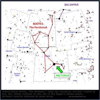
Mesopotamia is by no means the only province of high culture where the astronomers worked with a tripartition of the sphere -- even apart from the notion allegedly most familiar to us, in reality most unknown -- that of the "Ways" of Zeus, Poseidon, and Hades as given by Homer. The Indians have a very similar scheme of dividing the sky into Ways (they even call them "ways"). And so have the Polynesians, who tell us many details about the stars belonging to the three zones (and by which planet they were "begotten"); but nobody has thought it worth listening to the greatest navigators our globe has ever seen; nor has any ethnologist of our progressive times though it worth mentioning that the Polynesian megalithic "sanctuaries" (maraes) gained their imposing state of "holiness" (taboo) when the "Unu-boards" were present, these carved Unu-boards representing "the Pillars of Rumia," Rumia being comparable to the "Way of Anu," where Antares served as "pillar of entrance" (among the other "pillars": Aldebaran, Spica, Arcturus, Phaethon in Columba). 436-437.
The fact that this was all written and published before the rediscovery of the non-instrument navigation techniques that had been preserved among the people of Satawal and before the first voyage of Hokule'a on which Mau Piailug was the navigator is noteworthy -- it indicates that the authors of Hamlet's Mill were onto something, although they could not know it.

The fact that Nainoa Thompson has found it useful to divide the sky up into four "star lines," much the way the ancients including the ancient Polynesians divided up the sky into three "ways" is equally significant, and indicates that the ancient mythologies may well have preserved knowledge that was used for open-ocean non-instrument navigation as well.

In fact, it is quite clear that the wisdom and ocean lore preserved by Mau and his ancestors, and passed on to Nainoa Thompson and the other members of the Polynesian Voyaging Society -- where it is still used to great effect on amazing deepwater voyages across the mighty Pacific and beyond -- may be one of the most significant pieces of ancient wisdom that somehow survived through the ages (even though it came very close to dying out).

It can provide a window onto mysteries of mankind's ancient past that we might never have otherwise understood, or might have only been able to guess at without practical testing. Whether or not one believes that there may have been actual ancient contact between people who are traditionally thought to have been isolated by the mighty oceans is actually less important than the fact that such understanding of and division of the celestial sphere is clearly very handy for those who venture out into the great deeps in traditional vessels without modern instruments. Where it appears in other ancient cultures, we might suspect that some form of similar navigational skills might also have accompanied the celestial knowledge that was preserved in those traditions.

In this way, it appears that all of mankind owes the Polynesian Voyaging Society, and Mau Piailug and Nainoa Thompson, a tremendous debt of gratitude and respect.

Share

Share

The star Arcturus, or Hokule'a


In the previous post, we took a brief look at the amazing wayfinding prowess of the mariners who steer the double-hulled ocean-going canoe Hokule'a on voyages from the islands of Hawaii to destinations as far away as Tahiti, Aotearoa (New Zealand), Rarotonga, Nukuhiva, the West Coast of North America including Alaska, the coral atoll of Satawal in the Caroline Islands, and Japan, and which is scheduled to undertake a circumnavigation of the globe beginning in 2012.

Hokule'a is named for the star Arcturus, which is called Hokule'a ("Star of Gladness" or "Star of Joy") in Hawaii and Polynesia. Arcturus has added significance to Hawaii and celestial navigation such as that used by the ancient Polynesians because of its location in the celestial sphere at a declination of +19° 10' 56", which indicates the circle that it traces each day in relation to the celestial equator (positive declinations are towards the celestial north pole from the celestial equator, while negative declinations are towards the celestial south pole from the celestial equator).

This is significant to the Hawaiian Islands because they are situated on the globe at a latitude between just under19° north latitude and just over 22° north latitude. Because of this fact, Arcturus (or Hokule'a) is at zenith for observers at 19° north latitude, which includes observers in Hawaii. To understand why this is, think of the north star, which is at a declination of +90° (the celestial equator is designated as 0° declination, just as latitude on earth is measured from the 0° line of the terrestrial equator).

At the north pole on earth, which is 90° north latitude, the north star will be directly overhead. (actually, the earth's current north star is located at just over +89° declination, so an observer at the north pole would actually observe it making a tiny circle around the true celestial north pole). As an observer moves further south from there, the north star will begin to sink towards the horizon. After moving 10° south from the north pole, to 80° north latitude, the stars that will cross the zenith for an observer at that latitude will be those which are situated at a declination of +80°. Such as star will not stay directly overhead all the time (the way the north star would stay directly overhead for an observer at the terrestrial north pole), because it will make a circle in the sky as the earth turns. The circle made by a star at the same declination as the observer's terrestrial latitude will be a circle that goes through the zenith point of that particular location on earth.

For Hawaii, Arcturus moves along a circle which passes directly overhead, through the zenith, once every twenty-four hours (well, actually four minutes earlier each day, due to earth's progress around the sun, as explained in this previous post). For an outstanding discussion of the way that traditional wayfinders use the rising and setting of the stars to navigate across the open ocean without compasses or other modern equipment, see the series of web pages on the Polynesian Voyaging Society website (this page describes "Holding a Course" and contains diagrams showing the rising point of Hokule'a / Arcturus in the section entitled "Steering by the Stars" almost halfway down the long page; other web pages relating to Wayfinding can be located using the links in the menu along the right-border area near the top of the long web page).

If you are not familiar with the star Arcturus or Hokule'a, it is actually very easy to find throughout the year. Arcturus is the fourth-brightest fixed star in the sky (not counting the sun, which is not a "fixed star"), and the brightest in the ancient constellation Boötes, or "The Herdsman" (see illustration above). It is also known as Alpha Boötis.

To locate Arcturus, simply follow the "arc" of the handle of the Big Dipper (the final two stars in the Dipper's handle appear in the star map above, connected by a purple line; the rest of the Dipper is located in the direction of the words "Big Dipper" at the top of the diagram). Arcturus has an orange-red glow.

The rest of Boötes is easy to see, and it is a large and interesting constellation that will become increasingly familiar as you look for it in the sky each evening. This is a case in which the conceptual outlines created by the great H.A. Rey are particularly valuable: his outlines (added to the diagram above as red lines) make the constellation far easier to spot and far more memorable than do the flowery allegorical diagrams used in previous centuries (for an example of one of those for Boötes, see here) or than do the geometric and abstract outlines used by many modern star books and websites (for an example of the typical geometric outline of Boötes, see here).

In the outline created by H.A. Rey, the Herdsman is smoking a long-stemmed pipe which points towards the Big Dipper and actually comes very close to the Dipper's handle. You can see it on a dark night (the stars in the "pipe" are very faint).

Now you know more about Arcturus, or Hokule'a, the namesake of the famous vessel of the Polynesian Voyaging Society, and about the way its location in the sky relates to the location of the islands of Hawaii.

Below is a video of the great Israel Kamakawiwo'ole (1959 - 1997) singing "Hokule'a Star of Gladness."

Share

Share

Some thoughts on the Hokule'a


The above video contains an interview with master navigator and President of the Polynesian Voyaging Society, Nainoa Thompson, discussing the ocean-going double-hulled waʻa kaulua, Hokule'a.

In the video, he describes some of the traditional navigation techniques he uses to guide the vessel, as well as the importance of the Hokule'a in helping to restore a spirit that had been all but lost due to oppression. He also describes this voyaging canoe's role in refuting the demeaning theories of scholars who over the centuries had argued that the Polynesians drifted through the oceans unintentionally and only accidentally discovered the islands of the vast Pacific.

The amazing voyages of the Hokule'a are undertaken without modern navigational equipment such as GPS devices, and even without compasses: ancient traditional navigation techniques are employed instead. In a remarkable book entitled The Wayfinders: Why Ancient Wisdom Matters in the Modern World, author and National Geographic Society Explorer-in-Residence Wade Davis describes in compelling prose the techniques used on these journeys:
Enshrouded by the night, the canoe itself became the needle of a compass that was the sky. Behind us sat the navigator, a young woman named Ka'iulani, Nainoa's protege. She would remain awake for twenty-two hours a day for the entire voyage, sleeping only for fleeting moments when the mind demanded a rest.

Ka'iulani, like Nainoa and all of the experienced crew, could name and follow some 220 stars in the night sky. She knew and could track all the constellations, Scorpio and the Southern Cross, Orion, the Pleiades and the North Star, Polaris. But for her the most important stars were those low in the sky, the ones taht had just risen or were about to set. Nainoa explained: As the Earth rotates, every star comes up over the eastern horizon, describes an arc through the sky, and then sets on a westerly bearing. These two points on the horizon, where a specific star rises in the east and sets in the west, remain the same throughout the year, though the time at which a star emerges changes by four minutes every night. Thus, as long as one is able to commit to memory all the stars and their unique positions, the time at which each is to appear on a particular night, and their bearings as they break the horizon or slip beneath it, one can envision a 360-degree compass, which the Hawaiians divide conceptually into thirty-two star houses, each a segment on the horizon named for a celestial body. Any one star is only dependable for a time, for as it arcs through the sky its bearings change. But by then there will be another star breaking over the horizon, again on a bearing known by the navigator. [. . .]

[. . .] The navigator by day conceptually divides the horizon ahead and behind, each into sixteen parts, taking as cardinal points the rising and setting of the sun. Thus by day he or she replicates the star compass of the night. The metaphor is that the Hokule'a never moves. It simply waits, the axis mundi of the world, as the islands rise out of the sea to greet her. 57-58.
It is remarkable that the stars were so vitally important and so well known by the ancient civilizations whom condescending scholars also have long said could not possibly have navigated the oceans. Just as Nainoa Thompson in the video above is saddened and angered at the racism of those who once said that the Polynesians "didn't have the intelligence" to navigate more than 100 miles, we should be saddened and angered by any scholars whose conclusions are based upon racist suppositions.

I argued in my previous post that there appears to be clear evidence (or at least evidence that should be discussed more thoroughly and not dismissed out of hand) that ancient voyagers from many of the families of mankind came to the Americas from Europe, Africa, and Asia. That men of different ethnicity and physical characteristics may have dwelt together in peaceful coexistence at some point during that time is one possible conclusion suggested by the many different sculptures found in sites belonging to the mysterious ancient Olmecs. And yet to suggest today that such ancient voyages took place is dismissed as racism and ethnocentricity. This is unfortunate.

In a previous post I have argued that to assert that the ancient timeline of mankind may have been different from what we are taught today should not automatically be considered some form of racism or ethnocentricity, unless someone moves from saying "X may have happened thousands of years ago" to saying "because X happened thousands of years ago, group Y or Z is better / worse / more valuable / less respectable than group A or B." It is true that some people do say or think or suggest such conclusions, but that does not mean that everyone who suggests an alternative theory from the consensus intends to take away or detract from one group or another.

Wayfinders author Wade Davis argues that Thor Heyerdahl's theories are objectionable in this very manner, because he interprets Heyerdahl's theories as denying the culture of Polynesia its greatest achievement, which is "the ultimate insult" (47). We have examined the theories of Thor Heyerdahl in several previous posts (see here and here) and it is hard to see why arguing that the Polynesians may have come from the east to the west (as many of their own legends state and as Heyerdahl believed took place) rather than from the west to the east (as most historians today assert) means that one wants to deny them their achievements.

Thor Heyerdahl clearly believed that the Polynesians were incredible mariners who were capable of deliberate voyages from Hawaii to Aotearoa and all points in between. He himself relates the oral traditions of Polynesia describing voyages from Hawaii to Tahiti and back and says he believes they took place, and he notes the accuracy of the directions given for sailing from Aotearoa back to Hawaii, and states that he thinks such oral traditions demonstrate the ability to make such voyages deliberately and not by accident.

The fact is that nobody knows for certain what took place in mankind's distant past. We are very much in the position of detectives examining clues and piecing together theories, some of which appear more plausible than others. To declare that a culture or a people could or could not do something based on presuppositions of any sort is very unwise. This blog has already discussed numerous items of solid evidence for the likelihood that ancient cultures could and did know and do things that scholars and historians dismiss as impossible (there is evidence that the builders of the Giza pyramids and of Stonehenge knew the size and shape of the earth, for instance, and that the builders of Avebury Henge knew about earth's naturally-occurring telluric energy, and additional evidence that Avebury may have functioned as a training complex for open-ocean navigation). These are possibilities that scholars adamantly deny, and yet the evidence is at least worth further consideration, as is the evidence that ancient cultures from multiple continents visited the Americas.

Such possibilities are not brought up in an attempt to take anything away from any family of mankind. In fact, it is quite clear that the true story of mankind's ancient past, if it ever could be known, would show that the wisdom and accomplishments of our distant ancestors surpass anything we attribute to them today. The parts of that wisdom which have somehow been preserved, or revived, such as the ancient knowledge that enables the magnificent voyages of the Hawaiian navigators (and the techniques handed down through the generations to the late master wayfinder Mau Piailug) should humble the proud attitudes of those who believe that "modern technology" makes those who possess it superior to everyone else, and competent to judge what other cultures could or couldn't do.

There appears to have been an extremely sophisticated understanding of the stars and their importance that was shared across a very wide variety of cultures, and which was preserved in certain parts of the world long after it had been stamped out and forgotten in Europe (if indeed it was ever shared there beyond a limited circle). It is highly possible that this knowledge was connected with open-ocean navigation.

The intrepid men and women who pilot the Hokule'a today have proven beyond a doubt that very ancient techniques, based upon deep understanding of the stars and other signs present in the sea and sky, can enable deliberate and successful voyages across vast distances to very small targets.

Whether these capabilities are somehow connected to the little-understood capabilities and astronomical knowledge of other ancient civilizations and cultures is not certain, but where we find evidence of similar extreme awareness and understanding of the stars and the sun, we might be wise to remain open to possibilities that the consensus rejects as impossible.

Share