Viewing entries tagged
megaliths

Share

Great time of year to erect a menhir


Now is a great time to begin tracking the sun's path where you live, if you haven't done so already. You can erect a gnomon or a menhir in a part of your property where the shadows from other objects (such as trees, hedges, fences, or your house) will not interfere with its shadow during the day.

A gnomon is the general term for the central "fin" or obelisk in a sundial, designed to cast a shadow which has a definite point that can be tracked across the ground or the sundial surface. The word is derived from the Greek word "to know" and is related to the word "gnosis."

A menhir is a more specific term for the unhewn standing stones found throughout the world (and especially in western Europe and the British Isles), some of them of great size. The word is derived from French by way of Breton, a language spoken in Brittany and related to Brythonic (a Celtic language). It is composed of two words, men meaning stone and hir meaning long.

The fact that most menhirs found around the world are unhewn or undressed stone is another clue in the discussion found in the post "Who were the ancient Celts and Druids?" in which allegations of a connection between the ancient Hebrews and Phoenicians and the ancient Celts are examined. The Hebrew Scriptures stipulate in Exodus 20:25 "And if thou shalt make me an altar of stone, thou shalt not build it of hewn stone: for if thou lift up thy tool upon it, thou hast polluted it." We also find in Genesis 28:18 "And Jacob rose up early in the morning, and took the stone that he had put for his pillows, and set it up for a pillar, and poured oil upon the top of it."

In any event, if you set up a gnomon or a menhir on your property (or in some open space near your home), you can observe the changing shadows cast by the sun throughout the year. This phenomenon is caused by the tilt of the earth's axis, which causes the path taken by the sun (the "ecliptic") to change its angle as the earth goes around the sun (for this reason the tilt of the earth's axis is also known as "the obliquity of the ecliptic").

This tilt of the earth's axis causes the sun to rise and set in the northern hemisphere from a point furthest north at the summer solstice (where earth is now), which makes sense if you think of a globe with an axial tilt and its north pole pointed most directly towards the sun. During the opposite solstice, when the earth has moved around its path such that its north pole is pointed most directly away from the sun, the sun's rising and setting will be furthest south in the northern hemisphere.

This phenomenon is depicted in the rough sketch above. The earth's surface (with a menhir or gnomon) is drawn as a rectangle, with the east edge and west edge labeled. The unlabeled north edge is of course the one to the left and the unlabeled south edge the one to the right. Along the east edge, where the sun rises each morning, the rising points of the summer solstice, winter solstice, and both equinoxes are marked with the letters SS (for summer solstice), E (for the point at which the sun rises on both equinoxes), and WS (for winter solstice).

Note that the ecliptic path traveled by the sun looks like a "tilted rainbow" or arch in this diagram. The arch is more tilted at winter solstice (that is, its apex is closer to the horizon) than at summer solstice (when its apex is further from the horizon). This also makes sense if you imagine again the globe with an axial tilt going around the sun.

The differences in the tilt of the sun's path will create a different shadow length throughout the year. If you think about it for a moment, you will realize that the sun traveling along the more upright arc traveled by the sun at summer solstice will cast a shadow that is much closer to the gnomon or menhir than will the sun when it is traveling along the more tilted arc of winter solstice, which will cast a much longer shadow.

The path of the shadow will actually make a tight arc around the gnomon or menhir on summer solstice, which will gradually uncurl into a straight line at the equinoxes, and then begin to curve outward as it begins to approach winter solstice. The three lines approximating shadow paths made on the solstices and the equinox are sketched into the drawing above*.

This pattern was discussed previously in the post entitled "What are cross-quarter days?" and again in greater detail in the post on "The Solar Double Spiral," which included a link to an excellent site by artist Charles Ross illustrating this principle (to see the animation of the shadow field, follow the link and then click the link for "Solar Pyramid and Shadow Field" and then click the link for "Shadow Field"). That post also explains how this curling and uncurling shadow pattern is related to the ancient double spiral that represented the sun's path from one solstice to the other throughout the year.

So, if you don't have a sundial or menhir, today is a great day to set one up and begin tracking the shadows through the year. It takes only a small bit of commitment to set up a good one (certainly much less commitment than it takes to get a solar double spiral tattooed across the bridge of your nose).

* Note that this pattern is that which is found in between the tropics and the arctic or antarctic circles in either hemisphere. North and south of the arctic and antarctic circles, respectively, the sun will not rise at all during the winter, and will not set during the summer. From the equator to the lines of the tropics north and south of the equator, the sun will actually cast a shadow on either side of the gnomon or menhir depending upon the time of year. This is an important piece of information to know if you are ever stranded on a desert island like Robinson Crusoe or Tom Hanks: observation of the shadow of a gnomon or menhir can help you determine north and south, and whether you are within the two tropics or outside of them.

Share

Share

Vindication for Thor Heyerdahl


Here is a link to a recent story in the Telegraph UK entitled "Kon-Tiki explorer was partly right -- Polynesians had South American roots." It reports that new genetic research by a University of Oslo professor has discovered genes in blood samples taken from Easter Islanders in 1971 and 2008 that were previously only found in indigenous American populations.

Norwegian explorer and author Thor Heyerdahl (1914 - 2002) put forward the thesis that the original settlement of the Pacific islands of Polynesia most likely came from the east (North and South America) than from the west (Asia and Malaysia), providing extensive evidence to back up his argument which filled an 821-page book, and famously venturing out himself across the Pacific in the Kon-Tiki raft to prove that the currents from South America supported his theory.

These stories about the genetic research concerning Easter Island first began to surface in some news outlets around June 6 and June 7, only a week after this blog published a post entitled "A Memorial Day Meditation on the mystery of Easter Island" on May 31, in which we argued for Heyerdahl's theory.

We noted then that it continues to be fashionable to ridicule Heyerdahl's theory and cited an article by author Jared Diamond who declared that Heyerdahl "brushed aside overwhelming evidence that the Easter Islanders were typical Polynesians derived from Asia rather than the Americas and that their culture (including their statues) grew out of Polynesian culture."

Here is a link to an article published in the San Francisco Chronicle back in April (just over a month before this new genetic evidence was released) about Easter Island which mentions Thor Heyerdahl and Easter Island, calling him the "author of a few wildly popular (and even more wildly speculative) books about the place." Perhaps this article's author, Spud Hilton of the Chronicle, and Jared Diamond will soon be publishing apologies for their dismissive words about Heyerdahl.

Far from "brushing aside overwhelming evidence" or floating "wildly speculative" theories, Heyerdahl amassed overwhelming evidence in support of his argument, the vast bulk of which is never directly addressed by his critics. Now, modern science appears to have added new genetic evidence to Heyerdahl's pile of data about the origins of the Polynesian cultures of the Pacific ocean.

Heyerdahl noted that the prevailing currents (see map above) support migration from the Americas rather than from the west. In his 1953 work American Indians in the Pacific: The Theory behind the Kon-Tiki Expedition he noted that the Polynesians themselves in their oral history and legends always identified their ancestors came from the east to the west, and that the first land settled by their ancestors was a group of islands known as Hawaiki or Hawai'i. Heyerdahl notes that these traditions are held "quite independently on widely separated Polynesian islands" and also notes that the first islands that would be encountered by mariners sailing from the direction of the Americas would be Hawai'i and Easter Island (41).

While opponents of his theory argue that Hawaiki must refer to Java in Indonesia and that the Polynesians were simply mixed up about the direction of their ancient origins, Heyerdahl points out numerous problems with this theory, beginning with the direction of the prevailing winds and currents. He notes that the Polynesians were outstanding mariners, and could and did complete successful voyages against the wind and the currents over great distances, but argues that the first men to reach the scattered islands of the Pacific were not necessarily as skilled as their descendents later became. Of those first settlers of the vast Pacific, he says:
If they had come from the east, from America, they could have reached Polynesia even against their own will and intention, merely by clinging to any buoyant coastal craft that was driven to sea and carried west by the prevailing winds and currents. But, if they had come from the west, from Asia, they could have reached Polynesia only if they were already, before departure, expert mariners with a keen insight into navigation and highly developed craft with rigging capable of forcing an eastward journey against the prevailing wind. 41.
Those who argue that the ancestors of the Polynesians came from the direction of Asia and Malaysia or Indonesia must also explain where such a group came from, who were simultaneously expert mariners but whose descendents in Polynesia did not use technologies that were present in Indonesia and Melanesia from very ancient times, technologies such as the loom for weaving (Polynesians made bark cloth instead of woven cloth, while the loom was well known in Asia, Indonesia and Malaysia), iron (Captain Cook noted that the islanders he encountered appeared totally unaware of the value of the iron ore he saw deposited in streams when he first reached their islands), alcohol, shell currency, kite fishing techniques, and numerous other developments present in Indonesia and Malaysia from a very early period.

On the other hand, the Polynesian level of seafaring ability was far beyond anything displayed by any of the cultures or locations in Asia, Indonesia, or Malaysia where conventional theorists believe that they originated.

Again, those who hold the conventional theory must argue that these impressive seafaring people were so confused about direction that they got east and west reversed in their own legends, and thought their forefathers came from the east when they actually came from the west, and that when they said Hawaiki was to the east they were mistakenly referring to Java, which was to the west. And they maintain this despite the widespread oral traditions among the islanders that the early generations of Polynesian seafarers made numerous return voyages back to Hawaiki. He notes that:
During the first generations after the dispersal of the Maori-Polynesian people from Hawaiki, courageous mariners, from all the major islands, made return voyages to this first discovered island, to visit their relatives and the earliest Pacific abode of their sacred ancestors. A lively contact existed between the central Polynesian islands and Hawaiki, and even between New Zealand and Hawaiki, until this great maritime activity gradually ceased. The historical traditions of the New Zealand Maori are especially rich in detailed accounts of the arrival of their ancestors from Hawaiki and subsequent return voyages to the same islands. 41.
Heyerdahl also cites an ancient Maori chant, documented by the prolific researcher of Maori culture Dr. Peter H. Buck (born 1880, whose Maori name was Te Rangihiroa, and who achieved the rank of Major and earned the combat valor award of the DSO in World War I, where he served in Gallipoli and in France), in 1938. This traditional Maori chant concerned the voyage back to Hawaiki, and clearly indicates that that homeland was to the east, in the direction of the rising sun:
Now do I direct the bow of my canoe
To the opening whence arises the sun god,
Tami-nui-te-ra, Great-son-of-the-sun.
Let me not deviate from the course
But sail direct to the Homeland. Cited in Heyerdahl 58-59.
Are we to understand that the Maoris sailed to Java to visit Hawaiki but did not realize that it was in the direction of the setting sun instead of the rising sun? And yet this is the position that critics must maintain who argue that Hawaiki was really in Indonesia. It is also very strange that if numerous return voyages were made to Indonesia, no record exists in Indonesia of such contact, and the Polynesians who went there did not pick up the techniques for making alcohol, iron, woven fabric, or the others mentioned above from the people that they found there when they returned to their supposed Asian homeland. He also notes that there is no trace of influence of Buddhism or Hinduism in Polynesian culture, in spite of the very strong cultural influence of both in Indonesia and Asia stretching back to centuries BC (43).

In addition to all this evidence against the idea that the people of Polynesia came originally from the west and Asia to the east, Heyerdahl also presents voluminous evidence which argues for connections with peoples of North and South America, including the accomplished builders of the spectacular pyramids and statues of Peru, and that the stone sculptures of Easter Island and the megalithic "arch" and pyramids of Tonga resemble those of Peru, Bolivia, and elsewhere in the Americas more than anything from Asia.

He also presents startling similarities between Polynesian culture and many aspects of the culture of the Northwest Indians (Native Americans) such as the Kwakiutl, the Nootka and the Haida. He was not the first to note these similarities -- many early European explorers who visited Polynesia and then the Northwest (including Captain Cook) were struck by these amazing similarities, and remarked upon them in their logs and records. They especially noted the similarities to aspects of the Maori culture, many of which Heyerdahl lists and which are too numerous to include in detail here.

One of the most obvious similarities was the similarity between the magnificent oceangoing canoes of the Northwest Indians and those of the Polynesians. Below is a photograph from 1910 of an ocean canoe of the Kwakiutl (which apparently is an Anglicized version of the true name of this people, which is Kwakwaka'wakw).


These canoes were extremely seaworthy, capable of slicing their way over the mammoth ocean swells of the Pacific, and were the defining cultural artifact of those Northwest tribes, as described by an officer of the US Navy, A.P. Niblack (who achieved the rank of Admiral but made contact with the tribes of the Northwest as a young ensign) who in 1888 wrote:
The canoe is to the Northwest coast what the camel is to the desert. It is to the Indian of this region what the horse is to the Arab. It is the apple of his eye and the object of his solicitous attention and affection. It reaches its highest development in the world among the Haida of Queen Charlotte Islands. Cited in Heyerdahl 95.
Admiral Niblack was not the only observer to rate these canoes the finest ocean canoes in the world; American geologist and anthropologist William Henry Holmes (1846 - 1933) said of them, "These dugout canoes are often of great size, beauty, and seaworthiness, and are probably the world's highest achievement in this direction," and New Zealand professor and scholar John Macmillan Brown (1846 - 1935) said of the Northwest tribes, "Their canoes are large and roomy, capable of accommodating scores of men; they are made with great skill and artistic talent; they are of all primitive craft the most fitted for meeting the conditions of oceanic voyaging, and have a great resemblance to the Maori war canoe . . ." (cited in Heyerdahl 95).

The remarkable similarity to the wakas, or war canoes of the Maori, can be seen by comparing the photograph above to the beautiful waka in the photograph below:


Heyerdahl's book provides evidence of many further similarities beyond their shape and appearance (even though the similarities in shape and appearance, and their seaworthiness, are striking enough by themselves). Note also that the prevailing currents indicated on the map at the top of this post are quite favorable for a voyage from the islands of the Northwest tribes to Hawaii and the Pacific islands of Polynesia.

Finally, Heyerdahl offers what may be the most significant and amazing evidence that is rarely mentioned anywhere today, and that is the tradition of a culture hero who came among the Northwest tribes on foot, performing wonderful works and doing supernatural feats, and then went away over the ocean to be seen no more. An early visitor to the Kwakiutl, G. M. Dawson, who in 1888 published "Notes and Observations on the Kwakiool People of the Northern Part of Vancouver Island and Adjacent Coasts" (which contained a dictionary of about seven hundred Kwakiutl words, and which can be read in a sometimes very poor transcript from a microfiche online here) said, "The name of this hero, like other words in the language, is somewhat changed in the various dialects. After hearing it pronounced by a number of individuals in the northern part of Vancouver Island and on the west coast, I adopted 'Kan-e-a-ke-luh' as the most correct rendering" (Heyerdahl 148). Dawson records:
No one knows his origin or whence he came. He never travelled in a canoe, but always walked. He is regarded as a diety and as the creator.
and also:
At last Kan-e-a-ke-luh left Cape Scott finally, going very far away and disappearing altogher from mortal ken, so that the people supposed the sun to represent him. 148-149.
Heyerdahl notes the well-attested fact that a very similar legendary culture hero in Hawaii was named Kane, and in New Zealand among the Maori he was known as Tane (and that the Hawaiian letter "K" is consistently rendered in Maori by the letter "T")(149).

Even more startling is the fact that these legends are almost identical to the now-famous legends of a culture hero who moved among the ancestors of the ancient high civilizations of Central and South America, the Maya, the Inca, and the Aztecs, and that he was known as Viracocha but also as Conn or Kon-Tiki (and sometimes as Kon-Tiki Viracocha). Graham Hancock chronicles this legend in great detail in Fingerprints of the Gods, but Heyerdahl does as well in American Indians in the Pacific.

All of this evidence is perhaps even more conclusive than the recent genetic tests announced by the Telegraph yesterday. Nevertheless, even after this new vindication of Heyerdahl's thesis, the articles on the subject say that he was only partly right -- or even (in the less charitable description of the Norwegian professor who conducted the DNA tests themselves, cited at the end of the Telegraph article) that "Heyerdahl was wrong but not completely." The conventional theory that the Polynesians came from Asia appears to be very difficult to shake, and this new evidence is being seen as supporting a very small and unimportant contribution from the Americas.

However, as noted above, Heyerdahl presented far more evidence than he is given credit for -- evidence that should be sufficient to cause us to reconsider the assumptions of conventional history, and to believe that there may well have been contact across the oceans far earlier than conventional theorists would like to admit.

This new evidence should provide some vindication for the work of Thor Heyerdahl, although if his other evidence does not cause modern researchers to reconsider their opinion of his work and his theory, we should probably not be surprised if the gene tests do not either.


Share

Share

The Jomon, the origins of the Japanese, and mankind's ancient past


Here's a link to a recent article from Past Horizons discussing research into the ancient history of Japan.

The article is interesting for several reasons. First, the research into the ancient cultures of any area is interesting in its own right. Additionally, the ancient history of Japan is extremely interesting, particularly the mysterious culture known as the Jomon, who left behind fascinating pottery, figurines, and stone circles. The questions surrounding the Jomon are discussed in some detail in Graham Hancock's Underworld, and they are questions with important implications for the mysteries of mankind's ancient past.

Further, the article touches on the fact that political and social prejudices in Japan have strongly influenced the conclusions drawn from evidence found in the past, and that they continue to have an impact today. This tendency is not unique to Japan, and in fact can be seen to have operated to steer the research that has been done and the conclusions that have been reached in many other places, including England and the United States, as discussed in this previous post.

While it may be relatively easy to spot the prejudices that skewed conclusions in previous generations (such as in England and the United States in the 1920s and 1930s, or in Japan prior to 1950 as discussed in the above article), it is often more difficult to spot those that may be distorting the vision of academics today. For example, we have pointed out the way that a certain narrative about global warming and resource scarcity have led to new conclusions about the history of Easter Island which may be completely bogus.

The insistence by some groups that any historical narrative that threatens the idea that the Japanese have been isolated for over 20,000 years somehow diminishes their dignity or worth is also an example of another modern bias, which asserts the same thing about indigenous cultures in North and South America, or in New Zealand. Whatever we want to call this modern bias (perhaps "political correctness" is still the best term for it), it is a very narrow-minded view and one that tends towards the group politics and grievance-mongering that mars many institutions of higher learning today.

Thus, while the above article about the history of Japan may present some assertions about Japanese history as fact which may later turn out to be incorrect, it is valuable in that it reveals the topic of political and cultural pressures on scientific research and analysis, a subject that we often ignore or which we think only applies to the less-enlightened thinkers of previous centuries or decades.

We believe that the article's treatment of the Jomon culture as a somewhat primitive "hunter-gatherer culture" that was replaced by a more advanced culture "that could grow rice and forge both iron weapons and tools" may be incorrect. While the evidence that the Jomon were supplanted by a later influx of people very different from themselves may be correct, it is likely that the Jomon were not simply hunter-gatherers unable to grow crops or create advanced tools.

In fact, there is some evidence that the Jomon may be connected in some mysterious way to the ancient civilization that influenced cultures around the globe and which is discussed in the Mathisen Corollary and numerous books by other authors, including Graham Hancock.

Noteworthy in this regard is the Jomon figurine featured prominently in the Past Horizons article itself. In addition to the distinctive styling that is the hallmark of Jomon artifacts, the figurine features a very obvious example of the solar double spiral, discussed in some detail in this previous post. The direction of these spirals is no accident, and exactly parallels the double spiral found on Fajada Butte in Chaco Canyon, New Mexico which is pictured in the post discussing this ancient design. As discussed in that post, this double spiral is also found in the facial tattoos of the Maoris of New Zealand and those found on ancient mummies from the Tarim Basin, as well as in the very ancient carvings on megalithic mounds in Ireland which have a solar function.

While primitive hunter-gatherers would be aware of the sun's path throughout the year and its association with the changing of the seasons, the solar double spiral indicates a very advanced understanding of celestial mechanics, which even conventional scholarship associates with agricultural societies.

However, the entire conventional model of mankind's ancient past -- which assumes a very long period of hunter-gatherer activity followed by the discovery of agriculture and then the development of specialization and enough leisure time to pursue astronomy and other arts and architectural achievements such as pyramids and ziggurats -- is itself built upon political and social biases and beliefs which are held as dearly by most modern academics as the Japanese biases discussed in the article.

Many of these biases are related to a commitment to Darwinism, a commitment which reaches an absolutely religious fervor in some individuals. Suggestions that Darwin was wrong are as unwelcome in most schools and universities today as suggestions of ancient cultural pluralism appear to have been in Japan in the past.

There is extensive evidence that the entire conventional model of mankind's ancient past needs to be rethought, and probably discarded.

Share

Share

A Memorial Day meditation on the mystery of Easter Island


Easter Island of late has become a popular analogy to support a certain narrative about resource depletion.

According to this narrative, which can be found in many articles including this one from PBS Nova and this one from National Geographic, the inhabitants of Easter Island lived for several centuries "in harmony with their environment" but then depleted all their resources and collapsed into violence and perhaps cannibalism. Often, the famous Easter Island statues or 
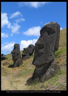
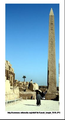
moai (sometimes thought of as Easter Island "heads," although they actually have full torsos but many are buried up to the neck, such as those pictured above) are blamed as the impetus for the depletion.

As Jared Diamond, the author of Guns, Germs and Steel, speculates in this 1995 article about Easter Island's depletion of resources:
With passing years, the statues and platforms became larger and larger, and the statues began sporting ten-ton red crowns -- probably in an escalating spiral of one-upmanship, as rival clans tried to surpass each other with shows of wealth and power. (In the same way, successive Egyptian pharaohs built ever-larger pyramids. Today Hollywood movie moguls near my home in Los Angeles are displaying their wealth and power by building ever more ostentatious mansions. [. . .] All that those buildings lack to make the message explicit are ten-ton red crowns).
In the article, Diamond articulates a theory that the Easter Islanders chopped down all the large trees to build canoes for hunting dolphins for food instead of farming, and for logs to roll their ever-larger and more-ostentatious moai around (he has since included this theory in his 2004 book Collapse: How Societies Choose to Fail or Succeed, which has popularized this view of Easter Island's past history).

The Nova article linked above quotes UCLA archaeologist Jo Anne Van Tilburg as saying: "The price they paid for the way they chose to articulate their spiritual and political ideas was an island world which came to be, in many ways, but a shadow of its former natural self."

All of this moralizing fits a certain politically-acceptable narrative current today, and it may be that we should be careful that our own modern biases and assumptions are not influencing the historical conclusions that we draw. We have discussed the danger of doing this, and how difficult it is for the "fish" to perceive the "water" that it is swimming in, in this previous post. Is it possible that later historians will look back at the narrative some are crafting today for Easter Island's history and realize that certain ardently-held beliefs about environmental depletion (which have reached an almost-religious fervor among some members of the intellectual class) colored the historical conclusions in the same way that certain ardently-held beliefs about eugenics colored the conclusions of some intellectuals during the nineteenth and early twentieth centuries, as discussed in that blog post?

Diamond's 1995 article mentions the work of Thor Heyerdahl, who in his 1953 work American Indians in the Pacific: The Theory behind the Kon-Tiki Expedition argued that Easter Island was settled by exiles from the high civilization that predated the Incas in the Andes and the coast of modern Peru. Like many other modern scholars for whom this theory is unappealing for various reasons, Diamond dismisses Heyerdahl's theory, lumping it with Erich von Daeniken's alien astronaut theory, saying: "Heyerdahl and von Daeniken both brushed aside overwhelming evidence that the Easter Islanders were typical Polynesians derived from Asia rather than the Americas and that their culture (including their statues) grew out of Polynesian culture."

This statement displays unfamiliarity with the arguments that Heyerdahl put forward in his well-documented and extensively-researched treatise (the first edition is 821 pages, in a 7" x 9" large-page format). Saying that the Easter Islanders were Polynesian does not contradict Heyerdahl, who argues that the Polynesians themselves originated from the Americas and moved west, with later contact with peoples from Asia and the Malaysian and Indonesian islands. He argues that Easter Island and the Hawaiian Islands would have been the first islands encountered by such a migration, and points to extensive evidence including the Easter Islander's own genealogies and oral histories that this is exactly what took place.

Far from "brushing aside overwhelming evidence," Heyerdahl provides extensive evidence that supports his thesis while discouraging the theory of Asian origins, including prevailing blood types, physical characteristics such as stature, nasal shape, and the presence of beards, the extensive practice of the medical procedure of trepanning which is found in the Americas and throughout Polynesia, the tradition of nose-rubbing as a greeting, fishing techniques and food types which are similar or identical to those of the Americas but different from those common in Asia and Malaysia, and the absence of fermented alcoholic beverages among the Polynesians prior to European contact in the 1600s and 1700s despite their presence in Asia and Malaysia (just to name a few among hundreds of other forms of evidence Heyerdahl examines in his book).

Indeed, if anyone can be said to have "brushed aside overwhelming evidence" it is not Heyerdahl but Diamond and the other modern researchers who dismiss his arguments.

In fact, as we have seen, there is extensive evidence that an ancient high civilization interacted with the populations of the Americas, and that the Polynesians were at least partly descended from people who created the impressive monuments that are found in Peru and around Lake Titicaca which spans Peru and Bolivia. This theory is distasteful to certain modern biases and political agendas, but it may be correct.

In such matters, the open-minded proposals with which Heyerdahl begins his 1953 work are more true than ever today. He states, "as long as there still are unsolved problems in the Pacific, we should at least give an open mind to the consideration of any solution however unimpressive it may at first seem to be" (3). Later, he approvingly cites "the following wise comment by [Edward Smith Craighill] Handy [1892 - 1980]" in a paper entitled "The Problem of Polynesian Origins," who said "there is only one sure way of being in the wrong, and that is by asserting dogmatically what is not true" (8). The italics are in Handy's original.

By asserting dogmatically that Heyerdahl's theory (or von Daeniken's for that matter) cannot be true, modern scholars appear to be falling into the trap that Handy and Heyerdahl himself are warning us against. This warning applies more generally to the entire subject of mankind's ancient past (and that of the earth's geology as well). We have discussed this subject previously using the analogy of the cholesterol-heart disease theory in posts such as this one.

In fact, there is much to support the theory that Easter Island was populated from the east by exiles from the monument-building culture of the Inca regions, and that hundreds of years later another group of Polynesians from further west came to Easter Island and wiped them out. First, the monumental moai of Easter Island have strong similarities to anthropomorphic stone statues found in Central and South America (including at Tiahuanaco). F.A. Allen's Polynesian Antiquities (1884) argues, "If it is merely a coincidence that these wonderful antiquities [on Easter Island], so closely resembling in character those of Peru and Central America, should exist on the very next land to the New-World, it is surely a most curious one . . ." (Heyerdahl 215).

Further, Heyerdahl notes extensive evidence for the elongation of the earlobes using a process that we call "gauging" today among the first inhabitants of Titicaca, including the mysterious Viracochas, a practice that was continued among the Incas (233-234). The earlobes were elongated to such a degree that they hung in some cases to the shoulders, and in order to keep them out of the way when not filled with a ring or a wooden block they would sometimes be hooked over the top of the ears or even tied together behind the head.

Significantly enough, Heyerdahl notes:
The sudden interruption of the megalithic work in the image quarry indicates the probability of a prehistoric invasion with tribal warfare on the island. Easter Island tradition is also very specific about such an early local war, which took place between their own ancestors and a legendary people referred to as the "long-ears," because they had the same extended earlobes as those seen on the statues. The adult men among the long-eared aborigines are said to have fled to fortify themselves on the extreme eastern headland, where finally they were all massacred in a ditch. [. . .] Thomson (1899), who collected the legends at a considerably earlier date, when they were less distorted, could even write: "The 'long-ears' appear to have been in power in the land at an early period in the history of the islands, though they were eventually defeated and exterminated by the others." (205).
Heyerdahl also notes that English archaeologist Katherine Routledge (1866 - 1935) wrote in The Mystery of Easter Island (1919):
According to the account of Admiral T. de Lapelin, there is a tradition at Mangarewa in the Gambier Islands to the effect that the adherents of a certain chief, being vanquished, sought safety in flight; they departed with a west wind in two big canoes, taking with them women, children, and all sorts of provisions. the party was never seen again, save for one man who subsequently returned to Mangarewa. From him it was learned that the fugitives had found an island in the middle of the seas, and disembarked in a little bay surrounded by mountains; where, finding traces of inhabitants, they had made fortifications of stone on one of the heights. A few days later they were attacked by a horde of natives armed with spears, but succeeded in defeating them. The victors then pitilessly massacred their opponents throughout the island, sparing only the women and children.
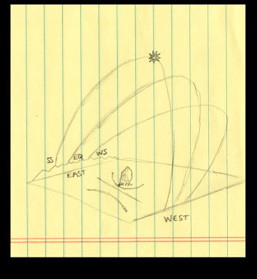
Heyerdahl notes on page 206 that if these Polynesians from Mangareva sailed east (with the "west wind" described in the account above), "there was no inhabited mountain island east of Mangareva save Pitcairn and Easter Island" (and Pitcairn was no longer inhabited when the mutineers from the Bounty settled there in the late 1700s, but Easter Island was inhabited when Dutch explorer Jacob Roggeveen landed there on Easter in 1722).

Thus, a completely different timeline emerges, in which long-eared descendents of the Viracocha people who built the Tiahuanaco Empire settled Easter Island and constructed the long-eared statues, but construction abruptly ceased when later Polynesian seafarers (themselves perhaps descended from seafarers originating in North, Central, and South America) came back to the east from Mangareva and massacred all the adult men, sparing only the women and children.

This timeline has much evidence to support it, including the not-inconsiderable fact of the actual oral histories of the Easter Islanders and Mangarevans themselves as told to the earliest European visitors.

Is it not possible that, in a desire to turn Easter Island into a morality tale supporting a certain modern narrative, much evidence is being overlooked? The Diamond and Van Tilburg quotations cited above both contain an overt admonishment against an imagined "arms race" of building larger and larger and more ostentatious moai at the expense of the environment, and a smug if unstated conclusion that "they got what they deserved" for such excessive consumption, but it may be that the real lesson of Easter Island is quite different.

In fact, the real lesson of the massacre of the "long-ears" by the "short-ears" may be that barbarity can always overwhelm civilization, and that the age-old human tendency to pit one group against another can bring constructive and culturative activity to a screeching halt. In this reading of the events of history, the moai of Easter Island are restored to the magnificent cultural achievement that they truly appear to be, rather than the despicable symbols of conspicuous consumption that Diamond wants to reduce them to (in a sort of displaced anger at the home-building activities of his wealthier Los Angeles neighbors).

On this Memorial Day, in which America remembers those who have fought and died in places like Normandy and Iwo Jima, it is perhaps appropriate to consider this possible lesson of Easter Island. We do not know what brought about the fall of the ancient civilizations that appear to have understood the size of the spherical earth, the mathematical concepts of pi and phi, the subtle astronomical process of precession, and the architectural techniques needed to build enormous pyramids and megalithic temples containing stones many tons in weight, but we do know that such knowledge was later lost for centuries and some of it is perhaps lost forever. As the Handy quotation cited by Heyerdahl counsels, we should be careful not to declare dogmatically that we know the answer or that other theories (especially those supported by careful analysis of extensive evidence) are wrong.

There are many today and in our own recent modern history who blame their problems on the success of another group, and believe that political power and even violence can be justifiably applied against those offending groups. This was the approach of Karl Marx, and it was the approach of the Nazis, against whom not only the Americans but the civilized people of the world fought and died in order to stop, not only those in uniform but also members of the underground in many occupied nations. Sadly, there are still people today who want to blame one group or another for their problems, and are not against massing power against that group in an attempt to remedy their grievances. I would suggest that this very tendency -- which we might see as analogous to pitting "short-ears" against "long-ears" -- is a strong candidate for the historical force which can destroy the fragile thing we call civilization, a force which has threatened to throw man into barbarity many times in the recent past, and which has succeeded in doing so many times as well.

If so, then it is a tendency that we should be very alert to detect, and to guard against in ourselves and others.


Share

Share

Malta: where's the drift?


The megalithic temples of Malta stand as mysterious evidence of a long-vanished people. Some of the stones used in these temples weigh between forty and fifty tons. Some of the temples featured precise solar alignments, and others contain windows that may have had lunar or stellar alignments.

Graham Hancock devotes considerable space in his book Underworld to an examination of these mysterious sites. He notes that the kidney-shaped layout of many of the temples appears to have no precedent in other megalithic architecture, and that there is little if any evidence of earlier or simpler temples on Malta -- those incorporating massive stones or precise alignments appear "out of nowhere" archaeologically speaking, as the earliest ones we find on the island.

He notes lower ocean levels in the past may have meant that Malta was not always an island, and that later sea level rise might have isolated Malta. We have discussed in previous posts the fact that sea level rise accords very well with the hydroplate theory of Walt Brown.

However, the megalithic remains on Malta make an even more powerful testimony in favor of the hydroplate theory, and that is the fact that they remain aligned with the equinoxes and solstices even after multiple thousands of years.

The southernmost room of the temple at Mnajdra contains precise alignments with the equinox and the solstices. As illustrated in the diagram above, the sun's rising on the summer solstice will cast a beam into the chamber to align with the edge of a prominent southern stone on the back wall, while the sun's rising on the winter solstice will cast a beam into the chamber to align with the edge of a prominent northern stone on the back wall.

In the northern hemisphere, the sun rises and sets from its most northern point on the summer solstice (hence the beam's angle illuminates furthest south within the chamber on this day), and rises and sets from its most southern point on the winter solstice (hence the beam's angle illuminates the furthest north within the chamber on this day). On the equinoxes, when the sun rises due east, the beam will enter the chamber directly through the east-aligned entrance, as shown in the diagram.

Even conventional historians place the date of construction of Mnajdra in the period between 3200 BC and 2800 BC (Hancock presents some arguments that the megalithic temples on Malta could in fact be much older). Even if we work with a date of 2800 BC for Mnajdra, this would imply over 4,800 years of continental drift, according to prevailing theories of plate tectonics. The continuing solar alignments of the Mnajdra temple contradict the theory of plate tectonics.

On the other hand, the hydroplate theory asserts that the continental plates did in fact slide as part of the events surrounding a worldwide flood, but that they came to a grinding and often violent halt prior to the runoff of the floodwaters (the buckling and uplift of the continents being part of the mechanism that initiated the runoff of the floodwaters, as well as the violent downward movement of the Pacific floor).

Since the structures on Malta (and all other structures still existing on earth today) had to have been built after the sliding finished and the floodwaters drained into the ocean basins, we would not expect major continued drifting to go on (according to Brown's theory, earthquakes are caused by shifting, rather than drifting).

Thus the alignments of the temples on Malta (whether they were built in 2800 BC or at some earlier date) support the hydroplate theory, while providing further arguments against the plate tectonic theory.

Share

Share

What are cross-quarter days?


Here's a little "back of the napkin" sketch of the sun's rising points as it marches north and south along the eastern horizon between the two solstices each year.

Imagine yourself high up in the air, looking down upon an obelisk which acts as a gnomon to cast a shadow upon the ground throughout the day as the sun makes its way across the sky. Perhaps you'd like to imagine that your obelisk is the one from the Temple of Karnak in Egypt shown below.


The obelisk in the sketch above looks like a square (because you are looking straight down on it) and it is shaded light blue. The sun will rise over the horizon in the east and move through the sky during the day towards the west (as the earth rotates towards the east, causing objects in the sky to appear to move in the opposite direction, just as a billboard seen from a car will appear to move backwards when the car is driving forwards). The path of the sun is depicted by dotted lines -- the arc of the sun's progress tilts at a slightly different angle each day because the earth is moving around the sun throughout the year, changing the angle we see the sun from our spot on the spinning earth. The shadow of the obelisk is depicted pointing west as the sun rises, one shadow for the summer solstice sunrise and another for the winter solstice sunrise.

Due to the tilt of the earth against the plane of the ecliptic (explained in more detail with more diagrams in the Mathisen Corollary), the position that the sun rises along the eastern horizon will move throughout the year. In the northern hemisphere (the obelisk at Karnak is at 25 degrees north latitude), the axis of the north pole will be most directly tilted towards the sun when the earth is at summer solstice, the point in its path that we call June 21 (our calendar slips a bit from year to year, but the leap years tend to keep our calendar date of June 21 close to the point when the earth is at the summer solstice). The sun will then rise at the most northern point that it ever gets along the eastern horizon (as shown in the diagram above by the most northern dotted arc, labeled "summer solstice").

Conversely, when earth reaches a point at which the north pole is tilted as far away from the sun as it ever gets (at December 21), the sun will rise as far south as it ever rises, and trace a different arc in the sky (shown above and labeled "winter solstice").

These arcs are drawn to depict the fact that the sun makes a much steeper arc through the sky on the summer solstice and a much flatter path on the winter solstice. Another way of describing this would be to imagine that each of these paths of the sun is a paper plate projecting from the flat surface below. The sun would travel along the outer edge of the plate. The summer solstice plate would be much more vertical and the winter solstice plate more horizontal, with its edge much more towards the south. An arrow or a pencil through these plates pointing towards the north pole (around which the entire sky turns) would be pointed much more towards the top of the diagram at the summer solstice and much more towards the viewer of the diagram at the winter solstice.

At the latitude of Karnak (25o north), the summer solstice sun will rise from a position along the horizon such that north will be 64o to the left of an azimuth shot from an observer towards the sun as it peeks over the eastern horizon. By winter solstice, the sun will rise so much further to the south that north will be 116o to the left of an azimuth shot by an observer towards the sun from the same point at Karnak at sunrise.

Back and forth the sun will move through the year, from one solstice to the other, as the earth goes around the sun between the two points on its orbit. Between each solstice, the sun will pass through the equinox position, on the days we call March 21 and September 22 each year. This will be the same point on the horizon because the sun will either pass it on its way north to the summer solstice (in the case of the spring equinox in March) or on its way back south to the winter solstice (in the case of the fall equinox in September). On either of these days, the sun will rise due east, and an observer sighting the sun's rise will know that north is exactly 90o to his left.

As an aside, it may appear that the sun's shadow will draw lines either north or south of the gnomon-obelisk, but in the northern hemisphere above the tropics these shadows will always be to the north of the gnomon. They actually make a curved line in order to accomplish this feat, which you can visualize by thinking about the tilt of the "paper plates" described above. Because the summer solstice arc is very steep, the shadow line will come very close to the gnomon (but always to the north of it) as the sun goes overhead. Conversely, in the winter, when the paper plate is much flatter to the page of our sketch, the line of the shadow will be much further to the north of the gnomon.

The ancients recognized the solstices and equinoxes and paid great attention to them in the alignment of their megalithic monuments and temples. However, they also aligned monuments and temples to dates known as the "cross-quarter days" which are in between the solstices and the equinoxes. These additional dates can be counted off starting from the spring equinox on the way to the summer solstice: the date between the March 21 spring equinox and the June 21 summer solstice is the important cross-quarter date of May 6 (today!). There is evidence that some ancient cultures began their year with this date, and also marked it as the start of summer. In the British Isles this cross-quarter day was called Beltane.

On May 6 at the latitude of Karnak, an observer looking at the sunrise could find north by going 72o to his left. From there, the sun continues its march to the summer solstice position, and then after a pause begins to move back towards the south. Before reaching the equinox position again, it will pass again through the point at which north would be 72o left of the rising sun (where it was on Beltane). It would pass that point around the day our calendars reach August 8th, another cross-quarter day.

From there, the sun would reach the fall or autumnal equinox on September 22, and continue on towards the winter solstice. Before it got there, however, it would pass through another cross-quarter day, on November 8. Now the sun would rise from a point on the horizon from which north would be 108o to the left.

From here, of course, the sun would continue on to the winter solstice. After a short pause, it would turn around again and proceed back to the north. It would pass through position at which north would be left 108o on February 4 or so on our modern calendar. Moving on, it would reach the spring equinox (rising due east again) on March 21, and proceed to the cross-quarter day of Beltane where we started this tour.

In centuries past, important festivals took place on the cross-quarter days, although for simplicity they were moved to the first days of the month (May 1 instead of May 6, or November 1 instead of November 8).

An excellent explanation of the cross-quarter days can be found in Martin Brennan's the Stars and the Stones, which illustrates the alignment of the passage mounds of the Boyne River in Ireland with the sun's rising (and sometimes setting) on different days for different mounds (some equinoctial, some solstitial, and others with cross-quarter days).

The late Barry Fell demonstrated that similar megalithic passages in North America were also aligned with solstices, equinoxes and cross-quarter days in America BC. He argued for the alignment of one megalithic chamber and gnomon in the Mystery Hill (now rebranded as "America's Stonehenge" in a marketing effort) site in New Hampshire with the sun's rise on Beltane, and argued convincingly that the grooves carved at that particular site were an early form of Ogham indicating a dedication to the sun-deity Bel.

There is some evidence, discussed in the Mathisen Corollary, that not all the ancients who established markers and observatories worshiped as deities the heavenly objects they were marking out, but instead were observing them scientifically just as we do today. There is a tension in many ancient writings between those who would worship these heavenly objects and those who worshiped the one who set them all in motion in the first place.

In any event, you now know the astronomical significance of May 6 and the other cross-quarter days.

Share

Stonehenge

Share

Stonehenge

Besides being beautiful and awe-inspiring in its own right, and a testament to the technological and aesthetic achievements of ancient mankind, Stonehenge is also an incredibly important source of clues for unraveling the mystery of the timeline of ancient history.

Deer bones and other items from beneath the outermost earthen embankment which encircles the site have been dated to around 3100 BC. The entire site consists of concentric circles of embankments, post holes, and trilithons -- massive post-and-lintel arrangements of three stones arranged as two pillars with a lintel stone across the top. Inside the inner Sarsen circle is a horseshoe arrangement (not circular) of five massive trilithons composed of mighty blocks weighing up to fifty tons each.

The question of who built Stonehenge, how they did it, and why remains open for exploration. In his 1999 book, Ancient Celtic New Zealand, Martin Doutré argues that the angles and measurements of prominent details of Stonehenge indicate that the site actually contains a scale model of the Great Pyramid of Giza.

The diagram above (click for greater detail) presents a rough illustration of Mr. Doutré's theory. The concentric blue circles and the horizontal line indicate the positions of: 1. the inner trilithon horseshoe, 2. the Sarsen circle, 3. the Y-holes, and 4. the Aubrey circle. The red lines indicate the outline of the Great Pyramid based upon Doutré's discovery that the diameter of the outermost perimeter of the site measures 378 feet: exactly half of the 756 feet that each side of the Great Pyramid measures.

Based upon this, he discovered indications that the apex of a half-scale two-dimensional representation of the Great Pyramid rested in the avenue leading to the Heel Stone as indicated. His entire argument, which goes into much greater detail about this and many other important aspects of Stonehenge should really be read in its entirety in his book, Ancient Celtic New Zealand, which belongs in the library of everyone interested in the subject of our earth and mankind's ancient past upon our earth (which is everyone, right?).

This discovery is just one piece of evidence that the Great Pyramid might actually predate Stonehenge, and that Stonehenge might well have been built by the people who once occupied Egypt and left, or by their descendents.

It is also an indication of the advanced technological, mathematical, and astronomical advancement of very ancient mankind, as both the Great Pyramid and Stonehenge incorporate elements which indicate a sophisticated understanding of pi and phi and even (as many have noted before) knowledge of the size of the spherical earth itself.

The Great Pyramid is a model of the earth, on a scale of 1:43,200. The base perimeter of the Great Pyramid is 3,023.154 feet, which multiplied by 43,200 yields 130,600,523 feet -- a number that approximates within an error of 1% the circumfrence of the earth (as Robert Bauval and Graham Hancock demonstrate in Keeper of Genesis). Anyone wishing to argue that this is mere coincidence must contend with the fact that 43,200 is a clear precessional number, as explained in this previous post.

If Stonehenge is a one-half representation of the Great Pyramid, then it too is an accurate scale model of the earth.

For these and other reasons, Stonehenge is a critical source of clues to the truth about mankind's ancient past. In the Mathisen Corollary, I argue that the hydroplate theoryof Dr. Walt Brown, which deals primarily with geological evidence of a catastrophic flood within human memory, provides an excellent explanation that fits the archaeological and mythological evidence of man's past as well.

He explains why precession (which is encoded by the number 43,200 at the Great Pyramid and at Stonehenge, as we have just seen) was caused by this ancient catastrophe, and even suggests: "Perhaps changes in earth's spin axis in the centuries after the flood motivated construction of ancient observatories such as Stonehenge" (7th edition of In the Beginning, page 117).

These connections are important to examine very closely.

Share